

The construction of "One Belt And One Road" will provide important development opportunities for Chinese steel enterprises to "go global". With the rapid development of China's national economy and steel and machinery industry, great progress has been made in the design
After the molten steel produced by the converter is refined by the refining furnace, the molten steel needs to be cast into billets of different types and specifications. Continuous casting section is the process of continuous casting the refined molten steel into billets. The main equipment includes rotary table, tundish, mold, tension leveller and so on.
In small steel production enterprises, at the time of purchase of rolling mill need most is the control of the money, and only is the limit for purchasing fund, leaving many small steel mills were forced to choose out or second-hand equipment of steel rolling on the market, in fact, in our rolling mill production enterprise

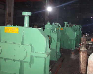
In the production of metallurgical steel rolling must do a good job in lubrication, for the normal operation of equipment to provide an important guarantee, to ensure the production efficiency of enterprises. Rolling steel production needs to use more mechanical equipment, such as rolling machine, reduction machine, gear machine,
Newly built and put into production in our country in recent years, a large number of hot rolling production line, cold rolling production line, etc., the production line equipment has the characteristics of automatization and high efficiency, modernization, and is equipped with advanced automation and computer control system, improve the automation level of the steel rolling
Continuous casting equipment mainly includes ladle and ladle turntable - tundish - ingot device - mold and mold vibration device - sector section (0 section, vertical section, bending section, arc section, straightening section, horizontal section) - billet cutting device (such as flame cutting machine) - deburring machine.
The construction of "One Belt And One Road" will provide important development opportunities for Chinese steel enterprises to "go global". With the rapid development of China's national economy and steel and machinery industry, great progress has been made in the design

|
Product display The product display Steel rolling equipmentContinuous casting equipment Rolling line accessories |
Contact us
Contact: Mr. Wang |
About us The About us Company profile The enterprise culture Our services Online consulting |